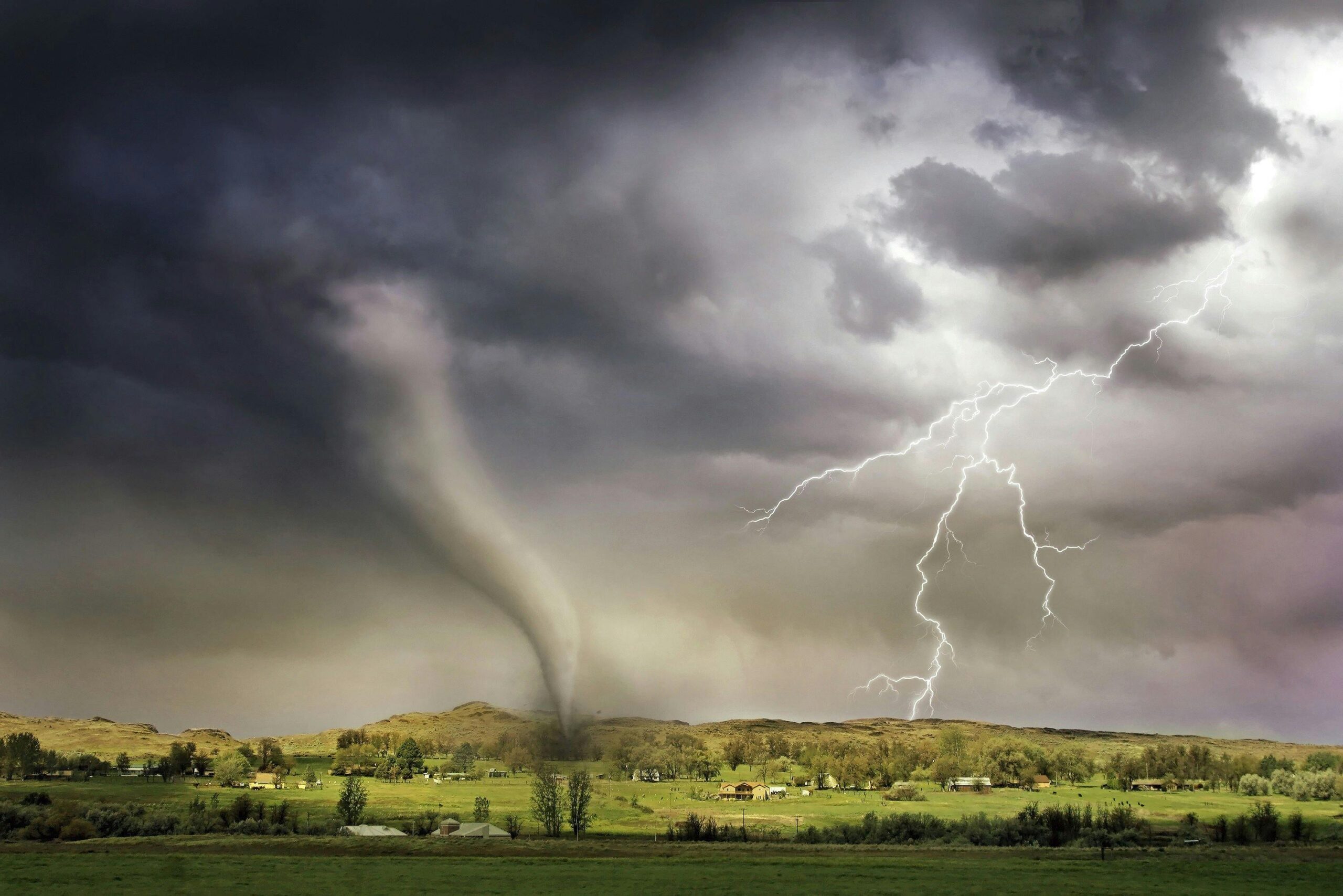
Tornadoes are among the most powerful and destructive weather phenomena on Earth. Known for their unique tubular shape, violent wind speeds and rapid development, they have fascinated and terrified humans for centuries. Understanding what tornadoes are, how they form, and where they strike can help you prepare for these swirling giants of nature.
Key Takeaways
- Tornadoes form when warm, moist air collides with cool, dry air under specific atmospheric conditions, creating violently rotating columns of air.
- Understanding the difference between tornado watches and warnings can be lifesaving – one means stay alert, the other means take immediate action.
- While Texas leads the nation in tornado activity, these powerful storms can occur in many states with varying frequency and intensity.
- Modern weather technology helps predict tornado conditions, but these storms remain difficult to forecast until they’re already forming.
- Tornado strength is measured by the damage they cause rather than wind speed, ranging from light property damage to complete destruction.

What is a Tornado?
A tornado is a rapidly rotating column of air that extends from a thunderstorm to the ground, and can reach wind speeds over 200 miles per hour. More violent twisters are capable of obliterating buildings, lifting vehicles, and uprooting trees. Most are relatively short-lived, lasting only a few minutes, but in some rare cases they can persist for over an hour and travel dozens of miles.
What Conditions Cause Tornadoes to Form?
Tornadoes typically form under conditions that are most common during severe thunderstorms, including:
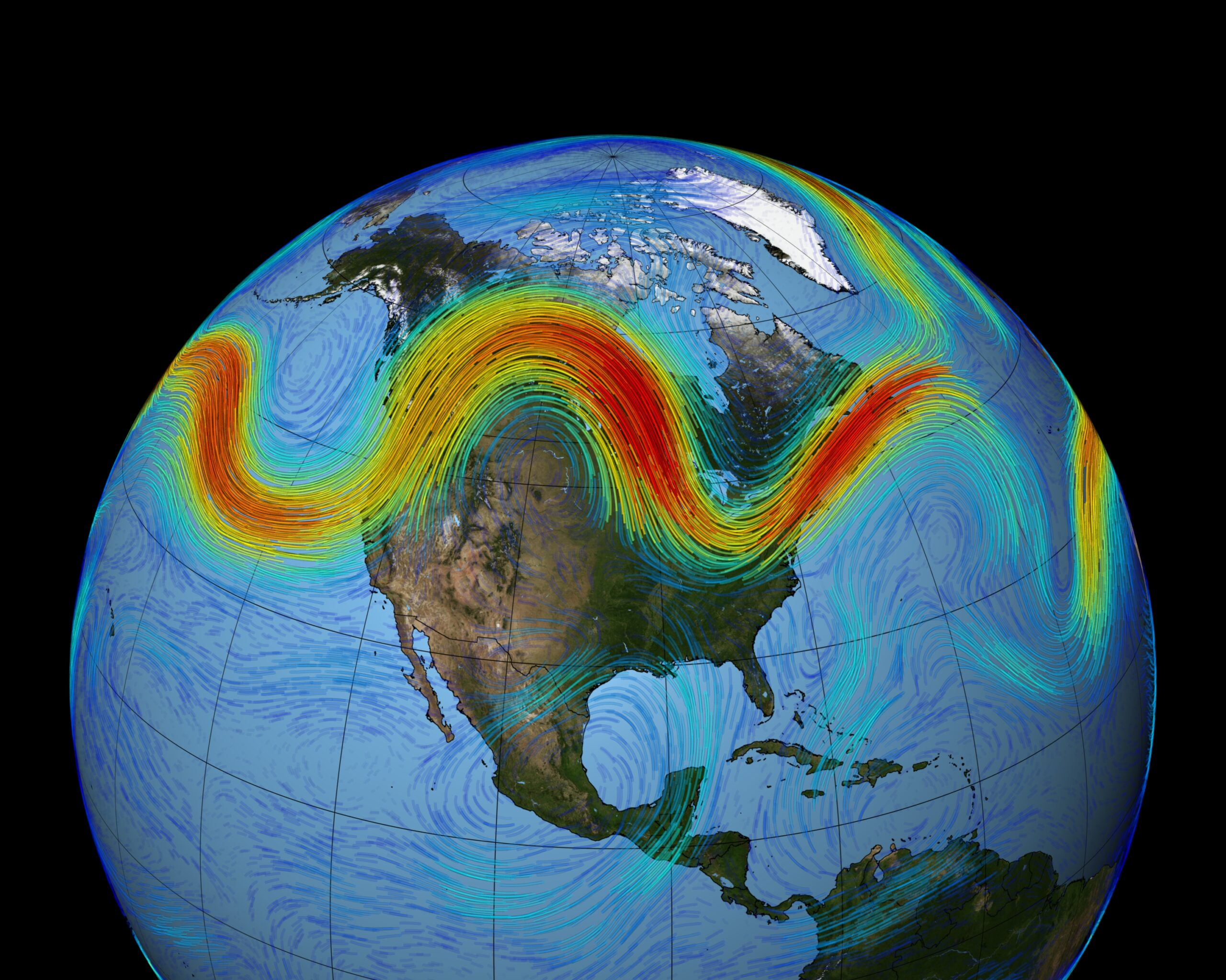
- Warm, moist air near the surface, typically originating in the Gulf of Mexico when it comes to tornadoes in the U.S.
- Cool, dry air aloft, often from the Rocky Mountains and Canada.
- Strong wind shear, meaning a significant change in wind speed and direction with altitude.
- Atmospheric instability, where warm air rises quickly into cooler upper layers
These ingredients together create an environment ripe for intense thunderstorms and, occasionally, tornadoes. In the United States, tornado season is typically marked as April to June, especially in “Tornado Alley”, as that is the time of year with the biggest contrast in temperature and humidity levels between the Gulf of Mexico & Rocky Mountains.

How do Tornadoes Form?
Tornadoes form when certain weather conditions cause a rotating column of air that extends from a thunderstorm cloud down to the ground. This fascinating yet dangerous process requires the perfect storm of ingredients, including temperature contrasts, wind shear, and atmospheric instability working together in a precise sequence.
The formation of a tornado is a complex process involving several steps:
- Development of a Supercell Thunderstorm: These storms have a rotating updraft known as a mesocyclone.
- Wind Shear and Rotation: Wind shear causes horizontal tubes of rotating air. As the storm strengthens, these horizontal tubes can be tilted vertically by the updraft.
- Formation of a Funnel Cloud: The rotation tightens and intensifies, forming a visible funnel as moisture condenses. This funnel cloud may or may not reach the ground. This is the visible part of a tornado that gives it such a distinct and intimidating appearance.
- Touchdown: If the funnel cloud descends and makes contact with the ground, it officially becomes a tornado.
How and Why Tornadoes Dissipate
Tornadoes eventually weaken and dissipate due to changes in the storm’s structure or environment. Like a hurricane, thunderstorms and tornadoes get their energy from warm, moist air. This means the most common cause for a tornado to dissipate is that it simply runs out of energy when there isn’t enough of that humid air left to fuel the storm or supercell.
Supercells also create a downdraft of dry air behind them as they move, called a rear flank downdraft, and sometimes that downdraft can wrap around the front of the supercell and disrupt the mesocyclone, ending the tornado. Without the proper inflow of air and structure, the tornado loses its strength, narrows, and eventually disappears.

Tornado Ratings Explained
Understanding tornado strength isn’t just about knowing they’re powerful – meteorologists use a specific scale to categorize these swirling giants based on the damage they cause. The Enhanced Fujita Scale, or EF Scale, rates tornadoes from EF0 to EF5, helping us understand just how destructive each tornado was after it passes through.
Unlike measuring wind speed with an anemometer in real-time, tornado ratings are determined after the fact by examining the damage left behind. This approach makes sense because it’s nearly impossible to get accurate wind measurements inside an active tornado – the very instruments needed to measure them would likely be destroyed by the storm itself.
The EF Scale Breakdown:
- EF0 (65-85 mph winds): Light damage – broken branches, damaged signs, shallow-rooted trees knocked over
- EF1 (86-110 mph winds): Moderate damage – roof surfaces peeled off, mobile homes overturned, exterior doors and windows broken
- EF2 (111-135 mph winds): Considerable damage – roofs torn off frame houses, mobile homes demolished, large trees snapped
- EF3 (136-165 mph winds): Severe damage – entire stories of well-constructed houses destroyed, heavy cars lifted and thrown
- EF4 (166-200 mph winds): Devastating damage – well-constructed houses leveled, cars thrown, small missiles generated
- EF5 (Over 200 mph winds): Incredible damage – strong frame houses leveled and blown away, automobile-sized missiles fly through the air
The vast majority of tornadoes, about 80%, are rated EF0 or EF1, while the catastrophic EF4 and EF5 tornadoes are extremely rare but account for most tornado-related fatalities. Understanding these ratings helps meteorologists, emergency responders, and communities better prepare for and respond to these remarkable yet dangerous weather phenomena.
Tornado Hotspots in the United States
While tornadoes can occur in many parts of the world, the United States experiences more tornadoes than any other country. The most tornado-prone area is known as Tornado Alley, which includes South Dakota, Nebraska, Kansas, Oklahoma and parts of Texas.
However, tornadoes are not confined to Tornado Alley. States in the Southeast, such as Alabama and Mississippi, are also frequent targets, particularly during the spring and fall tornado seasons. These regions have even been dubbed “Dixie Alley” due to the increasing frequency and severity of tornado outbreaks there.
Weather Instruments that Predict Tornadoes
Because tornadoes form so rapidly, and require so many different conditions to come together at the same time, predicting them is an inexact science. Tools like Doppler radar and weather satellites are best for picking up the rotational aspect of a thunderstorm turning into a supercell, and later a tornado.
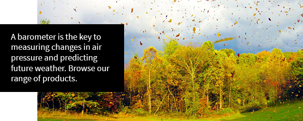
An instrument like a barometer will predict changes in atmospheric pressure, so it can help predict when thunderstorms are coming. A rapid drop in pressure indicates that a storm is coming, and the faster and further the pressure drops, the more severe the storm will be. Anemometers can also be used to track rapid changes in windspeed, which can be indicative of a tornado on the way, and are also used to measure the windspeeds that a tornado generates. However, there’s good reason that so many U.S. cities have tornado sirens to warn residents of an impending tornado, as they are very difficult to predict until mere moments before they’re formed.
Which Is Worse, a Warning or a Watch for Tornadoes?
When it comes to tornado alerts, understanding the difference between a watch and a warning could be the difference between staying safe and being caught off guard. A tornado warning is significantly more serious and urgent than a tornado watch.
A tornado watch means tornadoes could develop in your area. Think of it as nature setting the stage; all the atmospheric ingredients we discussed earlier are coming together, creating an environment where tornadoes could form. During a watch, you should stay alert, monitor weather updates, and have your safety plan ready to execute.
A tornado warning, on the other hand, means a tornado has been spotted by trained weather spotters or detected on radar. This is when immediate action is required. The rotating column of air we’ve been discussing has either formed or is in the process of forming, and you need to seek shelter immediately.
Key Differences at a Glance:
- Tornado Watch: Conditions are right for tornado formation – stay prepared
- Tornado Warning: A tornado has been spotted or detected – take shelter now
The confusion between these terms is understandable, but remembering this simple distinction can be lifesaving: tornado watches mean “be ready,” while tornado warnings mean “take action now.”
Just as a barometer helps predict changing weather conditions, these alert systems give you the precious time needed to protect yourself and your family when these powerful weather phenomena threaten your area.
Final Thoughts
Tornadoes are a complex and awe-inspiring weather phenomena that meteorologist are still studying as they are not understood to a 100% degree of certainty. The pure destructive power that they possess is evident every year, so awareness and preparedness remain key, especially in tornado-prone regions. By respecting their power and staying informed on changing weather conditions, you can keep yourself safe.
Tornado FAQs
Does Texas Get Tornadoes?
Yes, Texas experiences more tornadoes than any other state in the U.S., averaging around 137 tornadoes per year. The state’s large size and location make it a prime target, especially in the northern and eastern regions. Texas sits right in the heart of Tornado Alley, where warm, moist air from the Gulf of Mexico collides with cool, dry air from the north, creating the perfect recipe for severe thunderstorms and tornado formation.
Does California Get Tornadoes?
Yes, but California gets relatively few tornadoes compared to other states, typically only 11 per year. Most California tornadoes are weak (EF0 or EF1) and occur in the Central Valley during late fall and winter months. The state’s mountainous terrain and different weather patterns make it much less tornado-prone than the Great Plains, though waterspouts can occasionally form over coastal waters.
Does Arizona Get Tornadoes?
Yes, Arizona does get tornadoes, but they’re quite rare, usually fewer than 4-5 per year. Most occur during the summer monsoon season (July-September) when atmospheric conditions become more unstable. Arizona’s desert climate and terrain aren’t ideal for the strong temperature contrasts and wind shear that typically fuel tornado development, making them much less common than in traditional tornado-prone regions.
Will Hurricane Screens Protect Windows from Tornadoes in Florida?
Hurricane screens can provide some protection from tornado debris, but they’re not specifically designed for tornado conditions. While they’re excellent for hurricane-force winds and flying debris, tornadoes can generate much more intense and unpredictable projectiles. For tornado safety in Florida, your best protection is still getting to the lowest floor of a sturdy building, away from windows, rather than relying on any type of window protection.


