What is a Nor’Easter and Why The Name?
While winter storm warnings and heavy snowfall may be all too common in the northern hemisphere, Nor’easters are actually few and far between. To better understand these storms, our team of experts at Maximum is here to answer all your questions.
What is a Nor’easter and why the name?
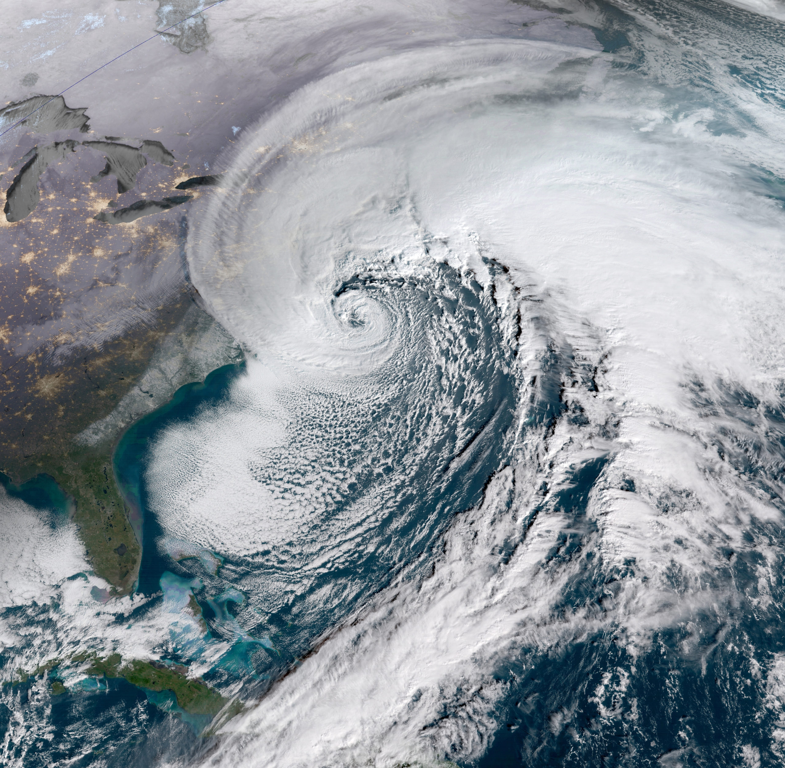
A Nor’easter is a storm along the East Coast of North America, so called because the winds over the coastal area are typically from the northeast. These storms may occur at any time of year but are most frequent and most violent between September and April. Some well-known Nor’easters include the notorious Blizzard of 1888, the “Ash Wednesday” storm of March 1962, the New England Blizzard of February 1978, the March 1993 “Superstorm” and the recent Boston snowstorms of January and February 2015. Past Nor’easters have been responsible for billions of dollars in damage, severe economic, transportation and human disruption, and, in some cases, disastrous coastal flooding. Damage from the worst storms can exceed one billion dollars.
Nor’easters usually develop in the latitudes between Georgia and New Jersey, within 100 miles east or west of the East Coast. These storms progress generally northeastward and typically attain maximum intensity near New England and the Maritime Provinces of Canada. They nearly always bring precipitation in the form of heavy rain or snow, as well as winds of gale force, rough seas, and, occasionally, coastal flooding to the affected regions. The heavily populated region between Washington D.C., Philadelphia, New York, and Boston, the “I-95 Corridor,” is especially impacted by Nor’easters.

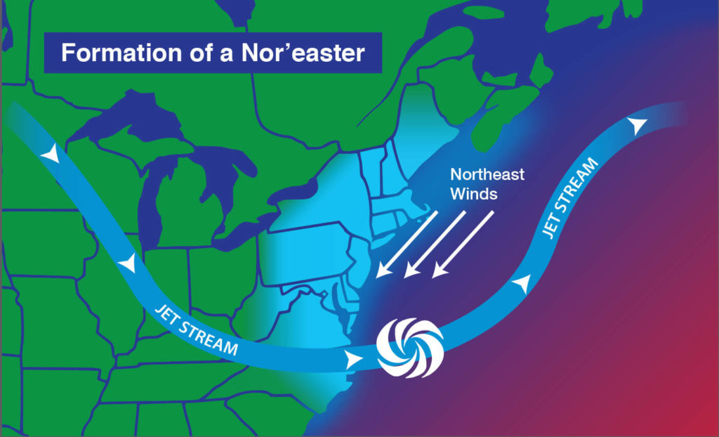
The U.S. East Coast provides an ideal breeding ground for Nor’easters. During winter, the polar jet stream transports cold Arctic air southward across the plains of Canada and the United States, then eastward toward the Atlantic Ocean where warm air from the Gulf of Mexico and the Atlantic tries to move northward. The warm waters of the Gulf Stream help keep the coastal waters relatively mild during the winter, which in turn helps warm the cold winter air over the water. This difference in temperature between the warm air over the water and cold Arctic air over the land is the fuel that feeds Nor’easters.
Weather forecasters at National Weather Service offices around the country and at the National Centers for Environmental Prediction near Washington, D.C., monitor conditions conducive for Nor’easters, especially during the fall and winter. When they see conditions are favorable in the upcoming days, forecasters may issue winter storm, blizzard, high wind, and coastal flood watches to alert the public that some of the worst effects of Nor’easters might be possible. If conditions are imminent, those watches are changed to warnings.
 What is the Difference Between a Nor’easter and a Blizzard?
Blizzard is a term often used when there is a significant winter storm. But certain conditions must be met for a storm to qualify as a blizzard; the distinction is not based solely on snowfall.
A nor’easter is a broad term used for storms that move along the Eastern Seaboard with winds that are typically from the northeast and that blow over coastal areas. A blizzard is a storm that has sustained wind gusts that exceed 35 miles per hour for at least three hours, along with blowing snow limiting visibility to less than a quarter mile.
What’s the Difference Between a Nor’easter and an Alberta Clipper?
A clipper (more accurately an Alberta Clipper) forms inland as a low-pressure system in Alberta, Canada. These winter storms move southeast into the Canadian plains and the Great Lakes before eventually moving offshore into the Atlantic Ocean—sometimes as far south as the Baltimore/Washington area. Clippers bring quick bursts of snow (one to three inches, with more in the mountains), colder temperatures and gusty winds (35-45 mph). Clippers occur most often from December through February.
Both are primarily winter storms created by low-pressure systems, both occur most often in fall through spring, both bring wind and snow although in different degrees. However, their points of origin are quite different: the clipper develops inland and moves offshore; the nor’easter begins offshore and moves inland.
Maximum Weather Instruments allow you to monitor condition changes that could possibly lead to a Nor’easter. Be prepared and check out all our instruments at www.maximum-inc.com